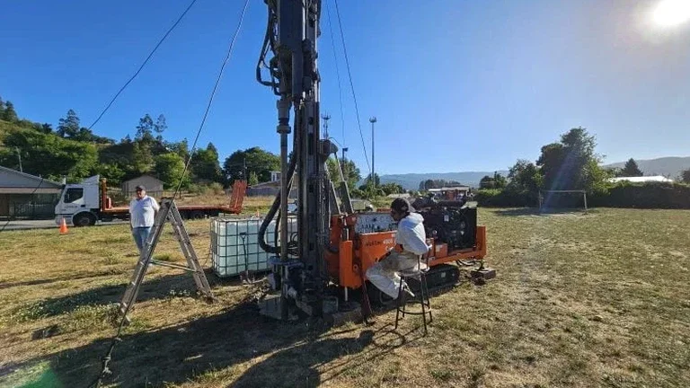
In Medicine Hat, where the South Saskatchewan River has carved a valley seven times deeper than its width through thick Cretaceous bedrock and glacial drift, understanding shallow subsurface conditions is fundamental to any construction project. The National Building Code of Canada (NBCC) requires a geotechnical investigation for all Part 9 and Part 4 structures, and within the city limits, the presence of Bearpaw Formation shales overlain by highly variable glacial till demands direct observation. An exploratory test pit allows our engineers to visually log stratigraphy, collect undisturbed samples for laboratory testing, and assess groundwater seepage conditions at depths typically up to 5 meters, providing data that borehole logs alone cannot capture when dealing with erratic till lenses or weathered bedrock contacts. For deeper investigations beyond the reach of standard excavation equipment, we often combine this approach with spt drilling to characterize the stiffer clays and shales that define the local geotechnical profile.
Direct observation of the Bearpaw Shale weathering profile in a test pit reveals desiccation fractures that lab tests alone would miss, fundamentally changing excavation support requirements.
Our approach and scope
Local considerations
Geotechnical conditions differ markedly between the upland residential areas of Crescent Heights and the commercial-industrial zone of the Flats. In Crescent Heights, test pits typically reveal a thin veneer of glacial till overlying competent, though highly plastic, Bearpaw shale—a profile that generally provides good bearing capacity but is susceptible to swelling with seasonal moisture changes. Down in the Flats, near the river, exploratory pits often encounter thick sequences of alluvial sand and silt interbedded with organic layers from historical flooding, creating a much higher risk of differential settlement and requiring deeper foundation support. Without a targeted investigation to map these transitions, a foundation designed for upland conditions would perform unpredictably if applied near the river terrace edge. The interface between these two regimes, often found along the valley slopes near 3rd Street NW, presents a unique challenge where shallow groundwater flow through sand lenses can destabilize excavations if not properly characterized during the site investigation phase.
Watch the video
Reference standards
NBCC 2020 Part 4 – Structural Design, CSA A23.3 – Design of Concrete Structures, ASTM D2488 – Visual-Manual Classification of Soils
Complementary services
Test Pit Excavation & Logging
Mechanical excavation using a tracked excavator to depths up to 5.5 meters, with continuous logging by a geotechnical engineer who documents stratigraphy, groundwater ingress, and any anthropogenic materials encountered in the urban fill.
In-Situ Sampling & Field Testing
Collection of Shelby tube samples from cohesive soils and bulk samples from granular layers directly from the pit floor and walls, combined with field vane shear tests to estimate undrained shear strength of the Bearpaw clays.
Combined Investigation Programs
Integration of exploratory test pit data with deeper CPT soundings for projects requiring both shallow characterization and pore pressure dissipation data in the alluvial sands near the South Saskatchewan River.
Typical parameters
Common questions
What depth can an exploratory test pit reach in Medicine Hat's soil conditions?
In Medicine Hat's typical glacial till and weathered Bearpaw Shale, a standard tracked excavator can safely reach depths between 4.5 and 5.5 meters. Deeper investigation requires shoring or a transition to drilling methods, per Alberta OHS Code requirements for excavations exceeding 3 meters where workers must enter.
What is the typical cost range for an exploratory test pit investigation in Medicine Hat?
For a standard program involving one to two test pits with engineering logging and sampling, clients in Medicine Hat can expect a cost range of CA$690 to CA$1,290, depending on access constraints, depth required, and the number of samples submitted for laboratory testing.
How does the Bearpaw Shale affect test pit stability?
The Bearpaw Formation shale in Medicine Hat is highly plastic and prone to desiccation fracturing near the surface. When exposed in a test pit, these fractures can open, leading to block fallout from pit walls. Our team evaluates fracture spacing and orientation during logging to determine if sloped or shored excavation is necessary for safe entry.
Can test pits identify the water table in the Medicine Hat Sand aquifer?
Yes, exploratory test pits are particularly effective at identifying perched water tables at the contact between the glacial till and the underlying Medicine Hat Sand. We monitor groundwater ingress during excavation and can install temporary observation wells if a longer-term assessment of seasonal fluctuation is required for foundation drainage design.